Most people searching Canal Istanbul route think they’ll find a simple line on a map. But here’s what usually happens instead. You see a few district names. Maybe a diagram. And then you’re left guessing what it actually means on the ground. That’s the gap.
Because the Canal Istanbul map isn’t just geography. It’s a story about how Istanbul might physically change over time. And once you understand where the canal passes, everything else starts to click. Real estate shifts. Infrastructure plans. Even local concerns about water and density.
So let’s make this simple.
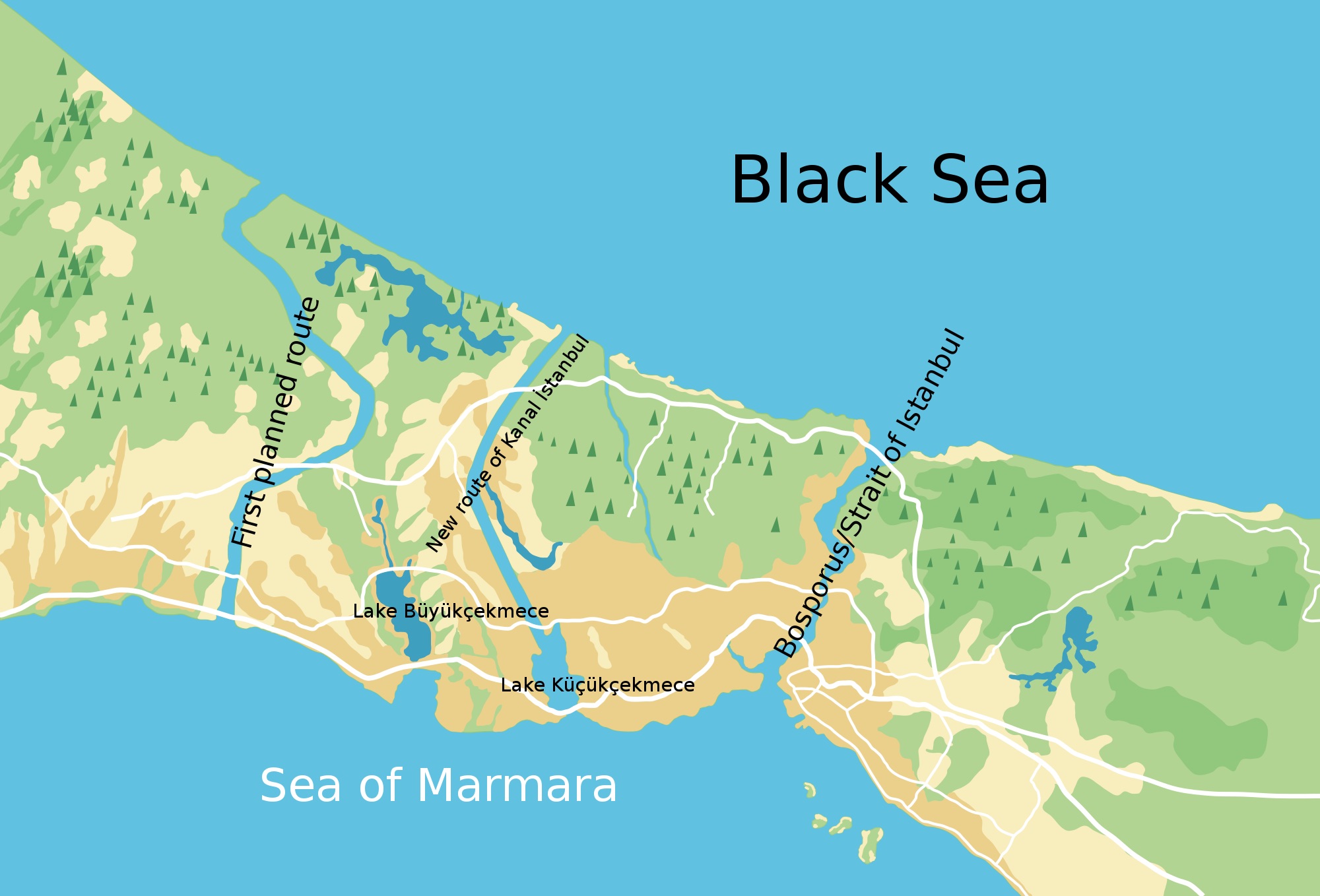
The Canal Istanbul route runs on the European side of Istanbul, starting from the Black Sea and cutting down toward the Sea of Marmara. But it doesn’t pass through empty land. It moves through very specific zones. Lakes, water basins, and rapidly developing districts like Küçükçekmece, Avcılar, Başakşehir, and Arnavutköy.
According to the official Kanal Istanbul Project data, this route was selected after multiple technical studies focused on navigation safety, terrain structure, and land availability. That sounds technical. But in real terms, it means this corridor was chosen because it could physically support a project of this scale.
Here’s what makes it more interesting. You can already trace parts of it today. Not as a canal, but as a pattern. Roads expanding. New housing clusters. Strategic infrastructure slowly appearing.
So in this guide, we’re not just answering where will Canal Istanbul pass. We’re walking the route step by step. Breaking down which districts are affected by Canal Istanbul. And showing what that actually looks like if you live, invest, or simply want to understand what’s coming next.
Canal Istanbul Route at a glance
- Canal Istanbul route is a planned artificial waterway connecting the Black Sea to the Sea of Marmara
- Runs on the European side of Istanbul, parallel and west of the Bosphorus
- Starts near Arnavutköy (Black Sea coast) and ends at Küçükçekmece Lake (Marmara)
- Main Canal Istanbul districts affected: Küçükçekmece, Avcılar, Başakşehir, Arnavutköy
- Passes through key natural areas: Küçükçekmece Lake, Sazlıdere basin, Black Sea coastline
- Approximate size: 45 km length, 275 m width, 20+ m depth
- Canal Istanbul map effectively creates a second water corridor, turning part of European Istanbul into an island-like structure
- The canal itself is not built yet, but surrounding infrastructure and development are progressing
- Areas affected by Canal Istanbul extend beyond the canal line into wider residential and development zones
- Highest future transformation expected in Arnavutköy and Başakşehir due to available land and ongoing projects
Canal Istanbul route explained
If you try to understand the Canal Istanbul route from a technical map, it feels abstract. Lines, labels, distances. But when you translate it into something visual, it becomes much clearer.
The Canal Istanbul route is a planned artificial corridor running on Istanbul’s European side, connecting the Black Sea in the north to the Sea of Marmara in the south. It passes through key natural and urban zones, including Küçükçekmece Lake, the Sazlıdere basin, and the developing areas of Arnavutköy.
That’s the simplest version. But here’s what matters more. It doesn’t follow an empty path. It cuts through active systems. Water, land, and growing districts.
No Regrets Booking Advice
Where it starts and where it ends
The northern entry point begins near the Black Sea coast, close to the Terkos region. From there, the canal moves southward, passing through inland areas before reaching the Sea of Marmara near Küçükçekmece.
So if you’re trying to picture the Canal Istanbul map, imagine a vertical line on the western side of Istanbul. Parallel to the Bosphorus, but farther out, crossing a mix of rural and semi-urban land.
According to the Kanal Istanbul Project, this alignment allows for a straighter and more controlled navigation channel compared to the natural curves of the Bosphorus.
Why this specific route was chosen
The route wasn’t chosen randomly. It’s the result of technical, environmental, and urban planning considerations. Geography played a major role. The terrain along this corridor is more suitable for excavation compared to other alternatives.
Water systems also influenced the decision. The canal intersects with existing basins, which makes the project both feasible and controversial at the same time.
And then there’s urban expansion. The western side of Istanbul has long been identified as a growth corridor. Placing the canal here aligns with broader development strategies.
Step-by-step Canal Istanbul route (from south to north)
Reading about the Canal Istanbul route is one thing. Walking it in your head is another. So let’s do that.
We’ll move from south to north. From the Sea of Marmara up to the Black Sea. Step by step, like you’re tracing the canal yourself.
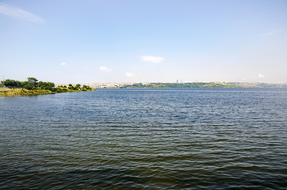
Küçükçekmece Lake (starting point)
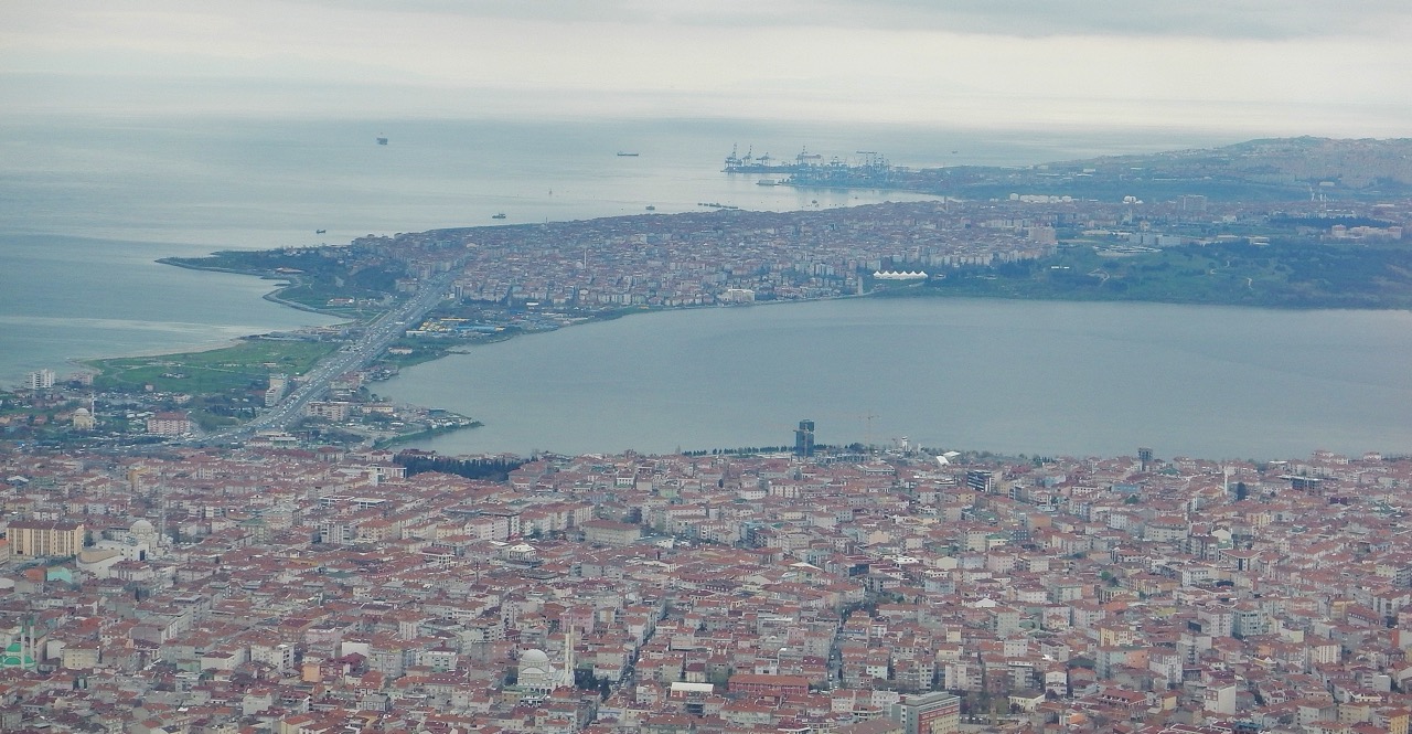
The southern entry begins near Küçükçekmece Lake, one of the most recognizable landmarks along the Canal Istanbul map.
This area already feels urban. Dense neighborhoods, major roads, and a coastline that connects directly to the Sea of Marmara. According to route plans referenced in official Kanal Istanbul Project documents, the canal would pass through or alongside this lagoon, effectively turning it into part of the waterway system.
And this is where the shift starts. You’re not in open land yet. You’re inside the city.
That’s why Canal Istanbul Küçükçekmece comes up so often in searches. It’s the most visible and immediate intersection between the project and daily urban life.
Sazlıdere basin and water corridor
As you move north, the landscape changes. The density drops. Buildings thin out. You begin entering the Sazlıdere basin, one of the most discussed zones in the areas affected by Canal Istanbul.
This is not just land. It’s part of Istanbul’s water system.
According to studies, this region plays a role in freshwater supply and ecological balance. That’s why this segment is at the center of the Canal Istanbul environmental impact debate.
Think about the contrast for a second. From dense urban shoreline to quiet water basin in just a few kilometers.
That transition is exactly what makes the route both feasible and sensitive.
Arnavutköy and Black Sea exit
Continue north, and you reach Arnavutköy. This is where the city starts to open up again and where Istanbul Airport is located. Larger plots of land, ongoing development, and a noticeable shift toward long-term planning zones. The canal would pass through this district before reaching the Black Sea coast.
This section feels different. Less built. More in transition. Which is why Canal Istanbul Arnavutköy is often linked to future development discussions and investment interest.
By the time you reach the northern exit, the full picture becomes clearer.
The Canal Istanbul route explained step by step is not just a straight line. It’s a gradual shift through different layers of the city. From dense urban life to critical water zones to expanding outer districts.
And each layer tells a different story about what might come next.
Which districts are affected by Canal Istanbul?
When people search which districts are affected by Canal Istanbul, they usually get a short list and nothing more. But the real answer is deeper than just naming districts.
Each area along the Canal Istanbul route sits at a different stage of development. And that changes everything. Risk, opportunity, and long-term impact all vary depending on where you are.
Let’s break it down properly.
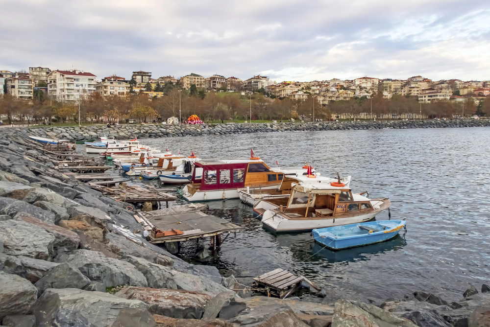
Küçükçekmece district impact
This is where the project feels closest to everyday life.
Canal Istanbul Küçükçekmece connects directly to the Sea of Marmara through the Küçükçekmece Lagoon. This district is already densely populated, with established neighborhoods, transport links, and coastal activity.
So the impact here is immediate. Construction pressure. Urban disruption. And long-term reshaping of the shoreline.
According to route details referenced in Kanal Istanbul Project, this southern section integrates directly into the canal system, making it one of the most sensitive entry points.
Avcılar district impact
Move slightly west, and Canal Istanbul Avcılar becomes part of the conversation.
Avcılar sits near the Marmara coastline and has a mix of residential density and older urban infrastructure. It’s also known for earthquake sensitivity, which adds another layer to the discussion.
Here, the concern is less about direct excavation and more about surrounding pressure. Increased development. Infrastructure strain. Potential population shifts.
This is where the canal’s indirect impact starts to show.
Başakşehir district impact
Now things shift. Canal Istanbul Başakşehir represents the planned side of Istanbul. Wide roads, organized housing developments, and ongoing expansion projects already define this district.
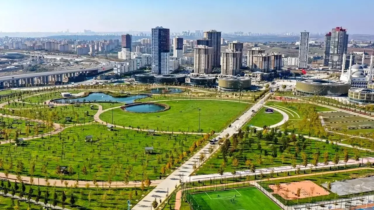
This makes it more adaptable.
Instead of disruption, the impact here leans toward integration. New infrastructure, transport connections, and planned urban growth could align with the canal’s long-term vision.
But there’s a trade-off. Growth comes with density. And density brings pressure.
Arnavutköy district impact
This is where the biggest transformation may happen. Canal Istanbul Arnavutköy sits along the northern section of the route, closer to the Black Sea. Compared to other districts, it still has more open land and development potential.
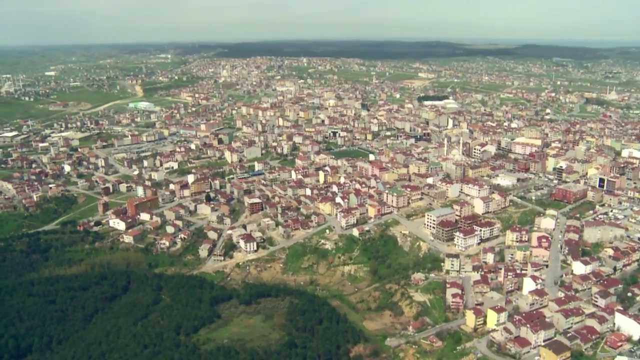
That’s exactly why it draws attention. Future housing zones. New infrastructure corridors. Long-term urban expansion.
According to environmental and planning discussions referenced in local reports, this area could experience the most visible change over time.
So, the areas impacted by Canal Istanbul are not equal.
Some face immediate pressure. Some absorb planned growth. And some are positioned for long-term transformation. And that difference is what makes the route so important to understand.
Why these areas were selected (not random)
At first, the Canal Istanbul route can feel arbitrary. A line drawn west of the Bosphorus. A few districts connected together. But once you look closer, you realize something. This path wasn’t chosen randomly. It’s the result of layered decisions.
Geography, water systems, and long-term city planning all intersect here.
Geography and land availability
Start with the most practical factor. Land. The western side of Istanbul offers something the central areas don’t. Space.
Compared to the dense, historic core along the Bosphorus, districts like Arnavutköy and parts of Başakşehir provide larger, less constrained land areas. That matters for a project of this scale.
According to the official Kanal Istanbul Project, the selected corridor allows for a straighter excavation path with fewer natural obstacles compared to alternative routes.
Think about it this way. You wouldn’t try to carve a canal through the busiest part of a city. You place it where the land gives you room to work. And that’s exactly what happened here.
Water systems and elevation
Now it gets more complex. The Canal Istanbul route intersects with key water features like Küçükçekmece Lake and the Sazlıdere basin. These aren’t just geographic points. They’re part of Istanbul’s natural water system.
This creates a paradox. On one hand, these areas make excavation more feasible. On the other, they introduce environmental sensitivity.
According to some reports, these water systems are central to concerns about freshwater supply and ecological balance. So the route is technically logical. But environmentally delicate.
Urban expansion strategy
This is the layer many people miss. The canal aligns with a broader vision of expanding Istanbul westward. For years, planners have identified this side of the city as a future growth corridor.
Districts along the Canal Istanbul districts line are already seeing structured development patterns. Roads, housing zones, and infrastructure projects are gradually extending into these areas.
So placing the canal here does two things at once. It creates a shipping route. And it anchors a new urban direction.
So, the Canal Istanbul route explained through this lens is not just about engineering. It’s about choosing where the city grows next. And once you see that, the route stops looking random.
It starts looking intentional.
What areas around the canal will change the most?
If you only focus on the Canal Istanbul route, you miss the bigger picture. The canal itself is just the center line. The real transformation happens around it.
And this is where things get interesting. Because the areas affected by Canal Istanbul extend far beyond the exact excavation path.
New residential zones and the Yenişehir concept
One of the most talked-about ideas tied to the Canal Istanbul project is the creation of a new planned urban zone, often referred to as Yenişehir. This isn’t just about adding housing.
It’s about building an entirely new urban structure along the canal corridor. Organized districts, modern infrastructure, and controlled expansion compared to older parts of Istanbul.
According to planning references connected to the Kanal Istanbul Project, these zones are intended to support population growth while easing pressure on central districts.
But here’s the nuance. New cities don’t stay “planned” forever. They evolve. Sometimes unpredictably.
That’s where both opportunity and risk sit side by side.
Infrastructure corridors and bridges
The second layer of change is infrastructure.
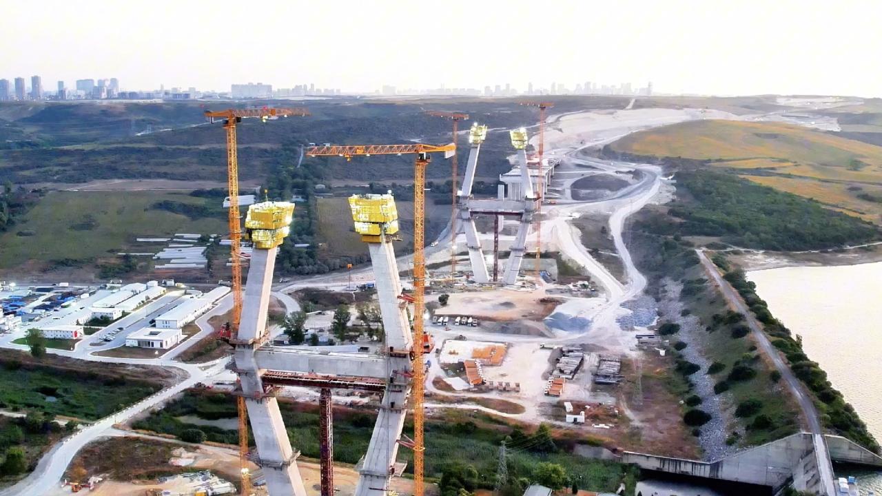
Bridges like the Sazlıdere crossing, expanded road networks, and future transport links are all designed to integrate the canal into the city. Even without full excavation, these projects already influence how people move across the European side.
And movement shapes everything. Commute patterns. Business locations. Daily routines.
So when people search Canal Istanbul map, what they’re really trying to understand is how mobility will shift.
Transport and logistics zones
Then there’s the economic layer. The canal corridor is expected to support logistics hubs, service areas, and transport-related infrastructure. That’s where the long-term economic vision of Canal Istanbul project comes into play.
But here’s a contrarian thought. Not all large infrastructure automatically creates balanced growth. Some areas accelerate quickly. Others get left behind.
So if you’re trying to understand what neighborhoods will change with Canal Istanbul, don’t just look at the canal line.
Look at the surrounding zones.
Because that’s where the transformation is already beginning.
Canal Istanbul map explained (how to visualize it)
Most people search Canal Istanbul map and expect clarity. Instead, they get diagrams that don’t quite translate into reality.
So let’s simplify it in a way that actually sticks.
Turning European Istanbul into an “island”
Here’s the easiest way to picture the Canal Istanbul route.
Imagine drawing a second vertical water line west of the Bosphorus. Now Istanbul’s European side is no longer a single landmass. It’s split again.
Bosphorus on the east. Canal on the west. What sits in between effectively becomes an island.
This is one of the most important ideas to understand. Because it changes how you think about the city’s structure, not just its transport.
Distance from the Bosphorus
The canal is not right next to the Bosphorus.
It sits several kilometers to the west, running through a mix of developed and semi-open land. According to route data from the Kanal Istanbul Project, this spacing was intentional to avoid dense historical zones and allow large-scale excavation.
So if you’re trying to visualize it:
Bosphorus = historic, dense, central
Canal = newer, expanding, outer corridor
Key landmarks along the route
Instead of thinking in lines, think in landmarks.
- Küçükçekmece Lake anchors the southern entry
- Sazlıdere basin forms the central water-sensitive zone
- Arnavutköy shapes the northern transition
- Black Sea coast marks the exit
According to environmental and planning references, these features are not just markers. They are the reason the route exists in this form.
What this route means for residents
When people look at the Canal Istanbul route, they often focus on the big picture. But if you live in Istanbul, the question feels more personal. What changes for your street, your commute, your daily life?
And the answer depends on where you are along the route.
Which neighborhoods face the biggest change?
Not all areas react the same way.
In Küçükçekmece, the impact feels immediate. Dense neighborhoods near the lagoon could see shoreline changes, construction pressure, and long-term urban reshaping.
Move north, and the picture shifts.
In parts of Başakşehir, the effect is more controlled. Planned developments can absorb change more easily. Infrastructure expands in a structured way.
Then you reach Arnavutköy.
This is where the biggest transformation is expected. More available land, ongoing projects, and long-term planning zones make it central to discussions about areas affected by Canal Istanbul.
According to some planning insights, these outer districts may experience the most visible shifts over time.
Daily life and transport shifts
Change doesn’t arrive all at once. It builds slowly. New roads appear. Traffic patterns adjust. Commute times stretch or shrink depending on infrastructure.
This is where the Canal Istanbul map becomes practical. It’s not just geography. It’s how movement across the city might evolve.
Think about it like this.
A new bridge or road doesn’t just connect two points.
It changes how people move between them.
And over time, that reshapes habits.
Water and environmental sensitivity zones
Then there’s the quieter concern. Water. The canal passes near sensitive zones like the Sazlıdere basin. According to studies cited in local reports, these areas play a role in Istanbul’s freshwater system.
That raises long-term questions. Not immediate disruption. But gradual impact.
So, you don’t need the canal to be finished to feel its effects. If you’re following which districts are affected by Canal Istanbul, the changes are already starting to show.
What this route means for investors
If you’re looking at the Canal Istanbul route from an investment angle, the first instinct is simple. Find the closest land. Buy early. Wait.
But here’s what we’ve learned. It’s rarely that straightforward.
Some areas move fast. Others stall. And timing matters more than location alone.
Early-stage vs late-stage districts
Not all Canal Istanbul districts are at the same point in the cycle.
Arnavutköy sits in what we’d call an early-stage phase. More available land, visible infrastructure expansion, and strong long-term positioning along the northern part of the route.
This is where most of the attention goes.
Then you have Başakşehir. More structured, more developed, already integrated into Istanbul’s expansion plans. Growth here tends to be steadier, less speculative.
And then there’s Küçükçekmece.
This is a different story. Dense, established, and closer to the Marmara entry. Investment here is less about expansion and more about transformation.
This difference is very important when evaluating Canal Istanbul real estate areas.
Where speculation is strongest
Let’s be honest. Speculation follows headlines.
Every time Canal Istanbul latest news resurfaces, interest spikes in areas closest to the planned route. Especially in districts where future development feels more open-ended.
But speculation has a pattern. It moves faster than reality.
Prices can rise before infrastructure fully supports them. And that creates risk.
Risks investors often ignore
Large-scale projects like Canal Istanbul project don’t follow predictable timelines. Financing, policy decisions, and public debate all influence progress.
That means holding periods can stretch longer than expected.
There’s also another layer.
Environmental and planning constraints. Areas near water basins or sensitive zones may face restrictions that affect long-term development potential.
So, if you’re evaluating areas impacted by Canal Istanbul, don’t just ask where. Ask when. Ask how. And ask what’s already changing on the ground.
Because that’s where the real signal is.
FAQs about Canal Istanbul route
Where exactly does Canal Istanbul pass through in Istanbul?
The Canal Istanbul route runs on the European side of the city, starting near the Black Sea coast and extending down to the Sea of Marmara. It passes through or near Arnavutköy, Başakşehir, Avcılar, and Küçükçekmece, with Küçükçekmece Lake forming part of the southern entry. According to the Kanal Istanbul Project, this alignment was selected for feasibility and navigation safety.
Which areas are closest to the Canal Istanbul route?
The areas closest to the Canal Istanbul map include neighborhoods around Küçükçekmece Lake, sections of Avcılar’s inland zones, parts of Başakşehir’s expanding residential districts, and large portions of Arnavutköy. These zones are already seeing gradual development activity, even though the canal itself is not yet constructed.
How wide will the Canal Istanbul corridor be across districts?
The canal itself is planned to be around 275 meters wide at minimum, but the total impact corridor is much wider. When you include infrastructure, buffer zones, and surrounding development areas, the footprint expands significantly. That’s why discussions about areas affected by Canal Istanbul often extend beyond the canal line itself.
Why does the route pass through water basins like Sazlıdere?
The route intersects with areas like the Sazlıdere basin partly due to geographical suitability for excavation. However, this also makes it one of the most debated segments. According to reports from the Istanbul Metropolitan Municipality Canal Istanbul Workshop, these water systems are central to concerns about environmental balance and freshwater supply.
Will the Canal Istanbul route change over time?
The core alignment of the Canal Istanbul route has remained relatively stable in official plans. However, surrounding zoning, infrastructure projects, and development priorities can evolve. That means the broader impact area may shift even if the main canal path stays the same.
How close is Canal Istanbul to the Bosphorus?
The canal runs several kilometers west of the Bosphorus, creating a parallel waterway rather than replacing it. This distance was chosen to avoid dense historical areas and allow large-scale construction. On the Canal Istanbul map, the two waterways form a kind of dual corridor across the European side of the city.
What natural landmarks define the Canal Istanbul route?
Key natural features along the route include Küçükçekmece Lake, the Sazlıdere basin, and the northern Black Sea coastline near Arnavutköy. These landmarks are not just geographic markers. They play a major role in shaping both the feasibility and the controversy of the project.
How can residents track changes along the Canal Istanbul route?
Residents can monitor infrastructure projects, zoning updates, and development patterns in districts along the route. Official planning announcements and local municipality updates often provide early signals. Following both helps build a clearer picture of how the Canal Istanbul route explained on paper translates into real-world change.
Which parts of the route are most likely to develop first?
Areas with existing infrastructure and planned expansion, especially parts of Başakşehir and Arnavutköy, are often seen as early development zones. These districts already align with Istanbul’s westward growth trend, making them more adaptable to change tied to the Canal Istanbul project.
How does the route affect long-term city planning?
The Canal Istanbul route is closely linked to broader urban planning strategies. It supports expansion toward the west, encourages new residential zones, and reshapes infrastructure networks. Over time, this could shift how the European side of Istanbul develops and connects internally.